The Art of Aerial Photography: Tips for Capturing Stunning Shots
The Art of Aerial Photography is a captivating way to showcase landscapes and urban scenes from a unique perspective. To capture stunning shots, it's essential to plan your shoots meticulously. Start by selecting the right time of day; the golden hours, just after sunrise and before sunset, provide the best natural light. Additionally, consider the weather conditions. A clear sky can enhance visibility, while a few clouds can add drama to your compositions. Remember, great aerial photography requires patience and practice, so don’t hesitate to experiment with different angles and heights.
Once you’re in the air, focus on key techniques to improve your shots. Using a wide-angle lens can create a sense of depth and allow for more expansive views. Composition is vital; follow the rule of thirds to guide where to place points of interest in your frame. Don't forget to incorporate leading lines or natural frames that draw the viewer's eye into the image. Finally, post-processing is just as important as the initial capture; enhancing colors and contrasts can transform an already stunning photograph into a breathtaking one.
Exploring the Benefits of Drone Technology in Wildlife Conservation
Drone technology has emerged as a powerful tool in wildlife conservation, offering innovative solutions to monitor and protect endangered species. By utilizing unmanned aerial vehicles (UAVs), researchers can survey vast and often inaccessible areas without causing disruption to the natural habitat. This allows for the collection of valuable data on wildlife populations, tracking movements, and identifying changes in the ecosystem. Moreover, drones can capture high-resolution images and videos, facilitating more accurate assessments of wildlife health and habitat conditions.
Additionally, the use of drones in wildlife conservation significantly enhances the efficiency of anti-poaching efforts. Equipped with thermal imaging and advanced surveillance technology, drones can detect illicit activities in real-time, allowing for rapid responses to poaching threats. This capability not only helps in protecting endangered species but also contributes to the overall balance of the ecosystem. As technology continues to evolve, the incorporation of drone technology in conservation strategies is likely to expand, providing a promising future for wildlife protection initiatives worldwide.
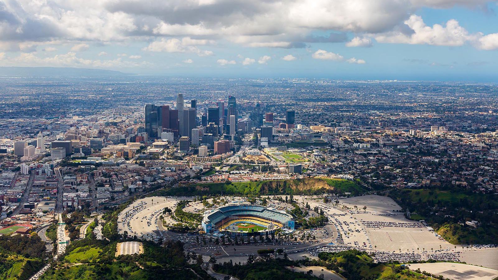
How Aerial Perspectives Transform Our Understanding of Geography and Urbanization
Aerial perspectives have revolutionized our understanding of geography and urbanization by offering a bird's-eye view of landscapes that traditional mapping methods cannot replicate. By utilizing advanced technologies such as drones and satellite imagery, researchers can analyze spatial relationships and patterns with unprecedented accuracy. For instance, aerial imagery allows urban planners to visualize city layouts, assess land use, and identify areas that require development or conservation. This comprehensive view not only enhances strategic planning but also facilitates effective resource management in rapidly urbanizing regions.
Furthermore, aerial perspectives foster a deeper appreciation for the intricate connections between natural ecosystems and urban environments. By examining towns and cities from above, we can observe how infrastructure impacts geographic features like river systems, forests, and wildlife habitats. This holistic view promotes sustainability by encouraging urban designers to incorporate green spaces and mitigate environmental impacts. As we continue to leverage aerial technologies, our understanding of the complex dynamics of geography and urbanization will evolve, paving the way for smarter, more sustainable cities that harmonize with their surrounding landscapes.